I’m anchored here, came in around 1:00 and am here for the night.

I’m covering off two days here. Sorry. I’m not big on writing when offline.
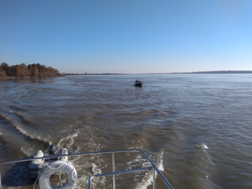
Yesterday was a lazy day most of the way. I slept in a bit, got underway about 0730 and hung around waiting for a southbound tow, thinking I’d do a repeat of Wednesday. But after 1/2 hour with nothing in sight I got impatient and headed south on the river. I saw this guy go by then passed him. Old sailboat mast down towing two PWC (jetski). Looked like solo, he said he’s going to LA.
The day was calm, sunny, maybe 15C. River was subdued, no logs. Towboat encounters were uneventful. Think I’ve got that figured out.


I met a cruise ship!

At mile 599 I passed the White River. I didn’t realize it at the time, but this is the navigation route to the Arkansas River. I had noted earlier that the Arkansas River met the Mississippi about 20 miles further down. Anyway, it seemed to be dumping an enormous amount of water into the Mississippi.
The ride got a little wilder after that. Probably more current than I’d seen before. Pretty solid 5 – 6 mph and sometimes more. I started seeing debris in the water again.
I should say the earlier in the day I had been following the shoreline rather than staying out in the middle. This was more scenic and interesting, and also gave me more options for avoiding the prop wash of northbound tows. They leave a lot of turbulence for a long way. The wing dams are all underwater and it’s pretty obvious where they are, both using the chart and the eyes, especially if sitting up top.
I passed a few houses that looked like more than cottages. First time since the Upper Mississippi


You can see lots of turbulence in the second pic. It’s 100 feet deep here, no control structures. Just a boil.
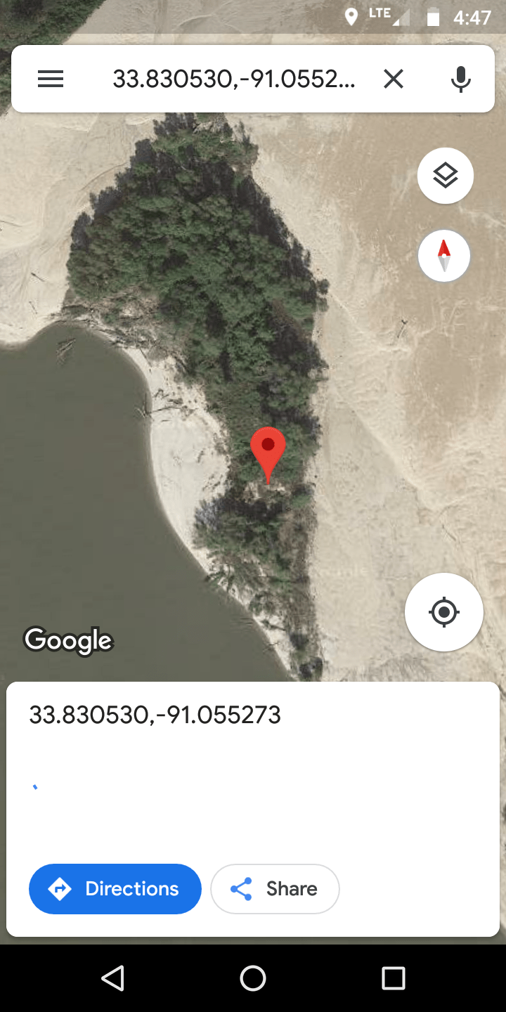
I was planning to stop in the Rosemont slack harbour, but in the interest of exploring poked my nose in here and anchored.
The cool thing is that this little channel only exists during high water. Here’s the satelite view
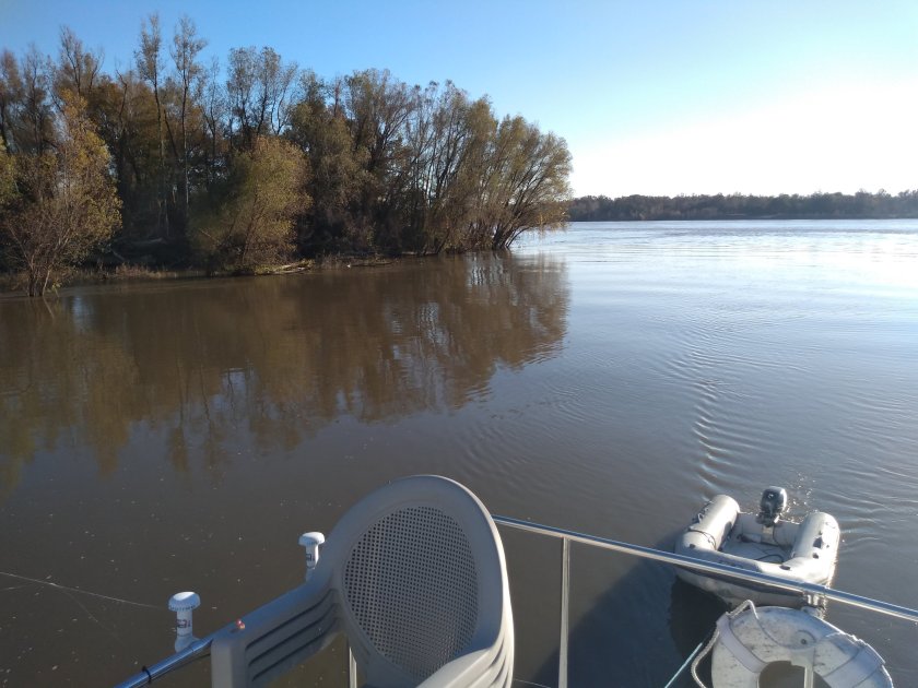
Anyway, it was very cozy and secure. Maybe 3 mph current and clean water


I hadn’t seen any internet connectivity most of the day, and there definitely wasn’t any there. I sent a text to Samantha to let her know I’d stopped and the text wouldn’t go through. Roaming carrier wanted me to pay for access. So after deliberation I tried to buy a cheap roaming pass, but then couldn’t use my credit card because I don’t have a zip code.
After much deliberation – such a pretty spot! – I got back underway and went a few miles down to Rosemont. I could see a water tower from where I was that appeared to be there, and I figured I could find internet or phone service to check in.
After anchoring here I dinghied into shore. Ran into a couple of locals who said there was a little village a couple of miles away but that everything was closed as it was Thanksgiving. They did say there was Verizon coverage inside the dike. So I biked about a mile, got briefly connected and checked in.
I wasn’t in any rush today, and by many reports this is the last place to go ashore for me. And it was rainy and windy this afternoon. And I have internet. So here I am. Had the heat blasting – I’m back to using the a/c system – and am thinking of going ashore for dinner.
Weather looks great for tomorrow. I’m feeling no rush as my deadline is two weeks to cover ~450 miles so will go slow and enjoy.

Those boils in the river remind me of the time I kayaked down the Fraser River, from Hope to Fort Langley. My kayak was only 13 feet and I didn’t have a rudder. That was hard work just keeping the boat going in a straight line. The river seemed to be just big boils all over the place. It was exhausting!
LikeLike