Boat Bling

I’ve got a good handle on the necessary repairs now. Bottom is fully repaired, prop is out for repair – I found some minor dings in the tips – turbocharger is being serviced.

I had a wish list when I arrived:

  1. AIS. I don’t care about transmitting – which allows others to see me – but a receiver is essential. So my plan is to replace my VHF with a new one that has AIS. I’ll also install a satellite mike on the flybridge and a speaker as well.
  2. A windlass.
  3. A new dinghy. Similar to the one I have but lighter. Mine is on its last legs

I got thinking of the windlass because a) everyone has one, b) I like the idea of having a winch of some sort to pull myself off if I go seriously aground, c) Crowley’s is a Lewmar repair center, and they have some deals on refurbished/surplus gear, and d) I could use a chain or partial chain anchor rode. I have a chain-rope rode now that has 30 feet of chain, and it’s really hard to handle without a windlass.

My current arrangement is using an all rope rode and either a 40 lb hook anchor or a Fortress fx23. I also carry a 45 lb plow anchor but have never used it. To be honest for pretty much all I’ve done so far it works for me. I get good exercise raising anchor. I haven’t been in areas where chafe was a concern. I typically lay out the rode neatly on the foredeck and let it dry out. Wander up and turn it over in the sun.

When I started thinking of the practical concerns about the installation. Of course a windlass is just part of a complete anchoring system. You need robust wiring, a dedicated battery, waterproof switches. And a good anchor locker, which I really don’t got. So I’m leaning towards not getting a windlass, at least a modern one. I’m now thinking that I’ll add a short chain leader to my rope rode for everyday use.

A new candidate has emerged though. Radar. I’ve been thinking lots about piloting and navigation since running up on the rock in Georgian Bay. There were lots of contributing factors, and I’m certainly not going to blame my tools. But a recent discussion on the AGLA forum was pretty persuasive. And a new radar is probably less $ than a windlass, looking at installed cost, although as always it’s easy to spend big bucks. The new digital units look super cool, but would require a new plotter. Maybe I don’t need a new dinghy right away…

Winter Plans

I was just rereading my earlier post outlining my plan for the summer. Things went more or less according to plan.

https://boatingadventuresblog.wordpress.com/2018/08/03/the-plan/

So. What’s next? Into the rivers and south.

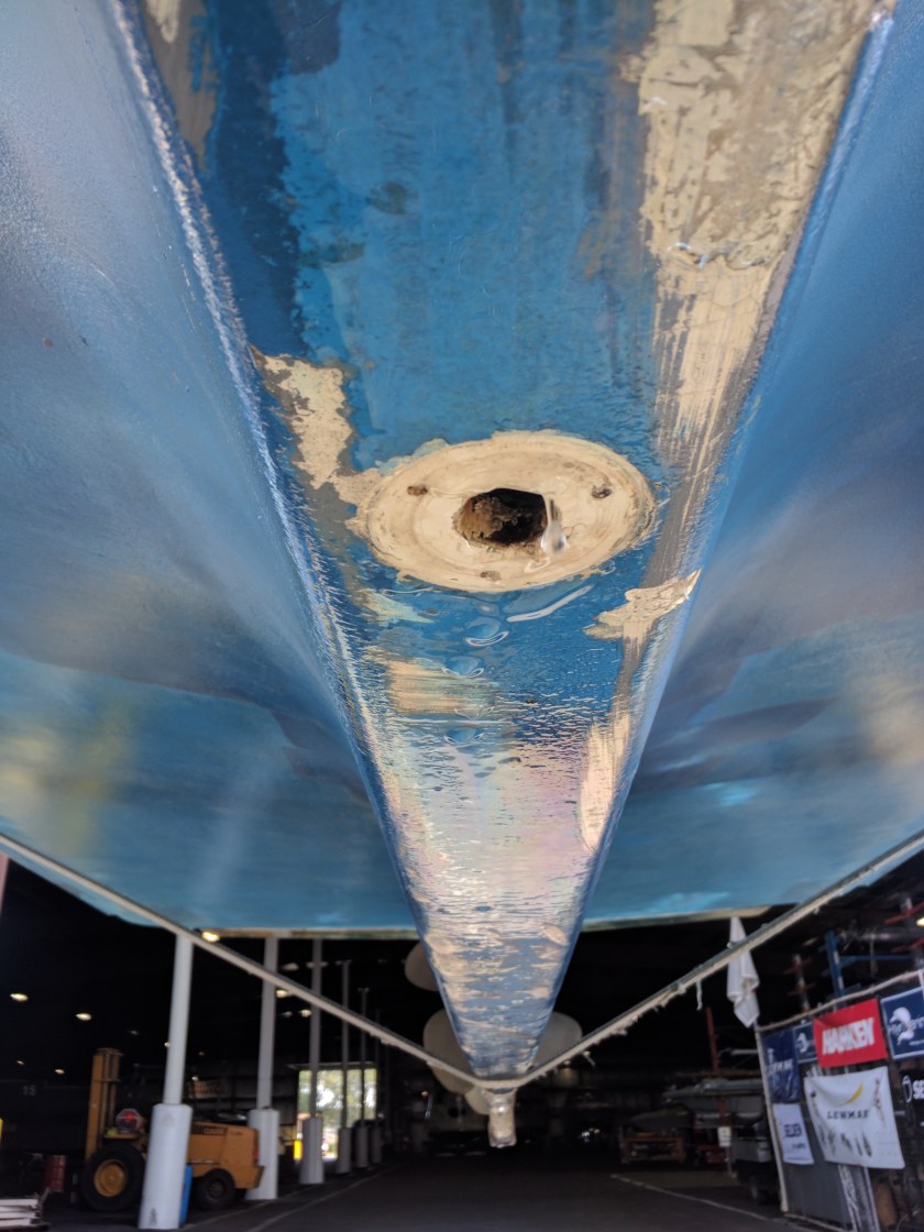
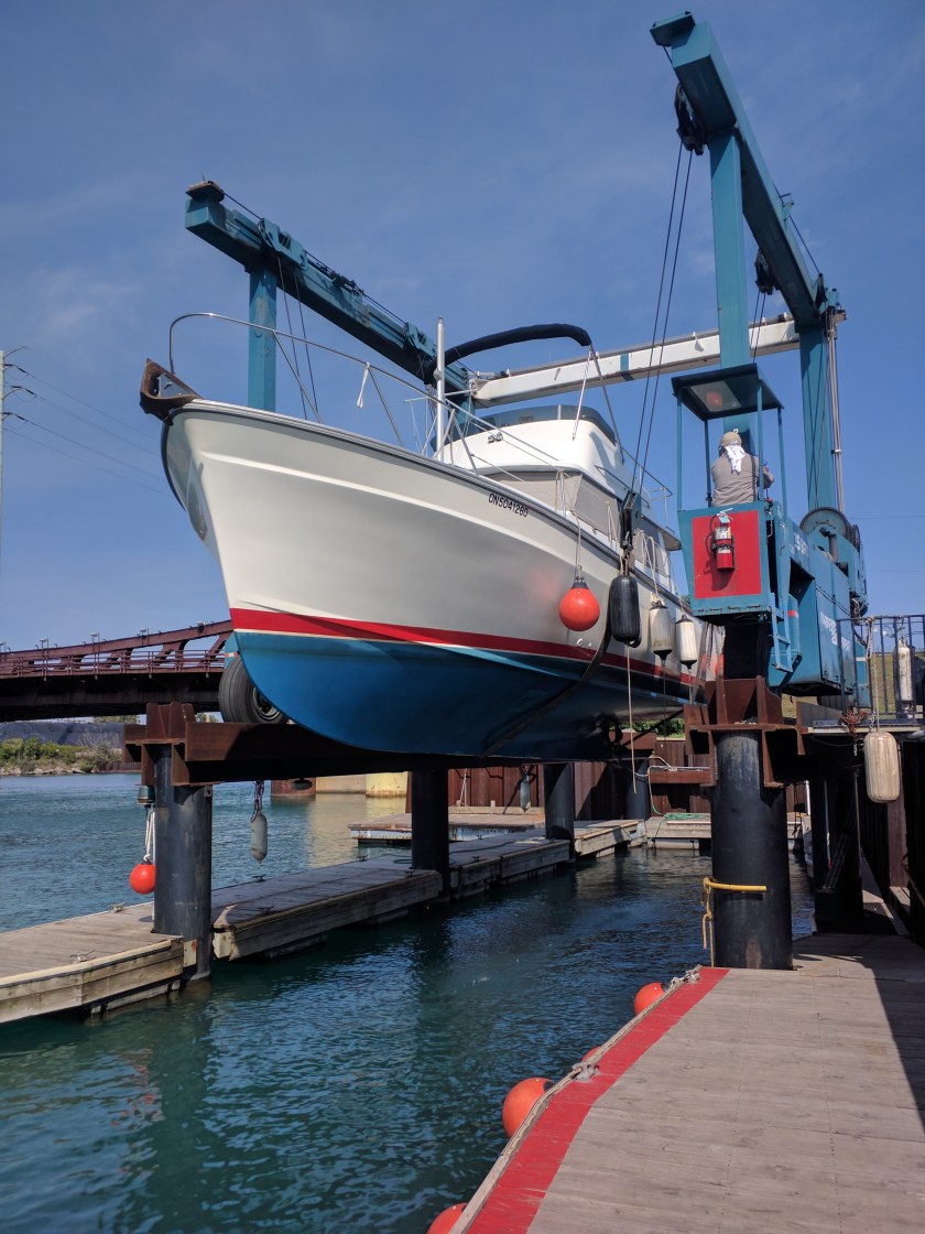
I’m super pleased to have been welcomed back at Crowley’s. I worked out of the old yard from 1989 – 93 and they were a class act then. They still are. Same active owner management and a team that includes many from my tenure. So I’m hanging there until Nov 2. I have a list of maintenance and improvements that they’re helping me with.

That puts me at the tail end of the fall migration. I’m ok with that. I generally avoid marinas, am self sufficient in terms of fuel and water, and have enclosed steering and heat. I’m not really afraid of the weather. But it does to an extent impose constraints. I’ve got to get below the snowbelt pretty quick, and everything is more enjoyable in fair weather.

Where do I want to end up? That’s the thing. I don’t really have a destination. But I do want to keep moving.

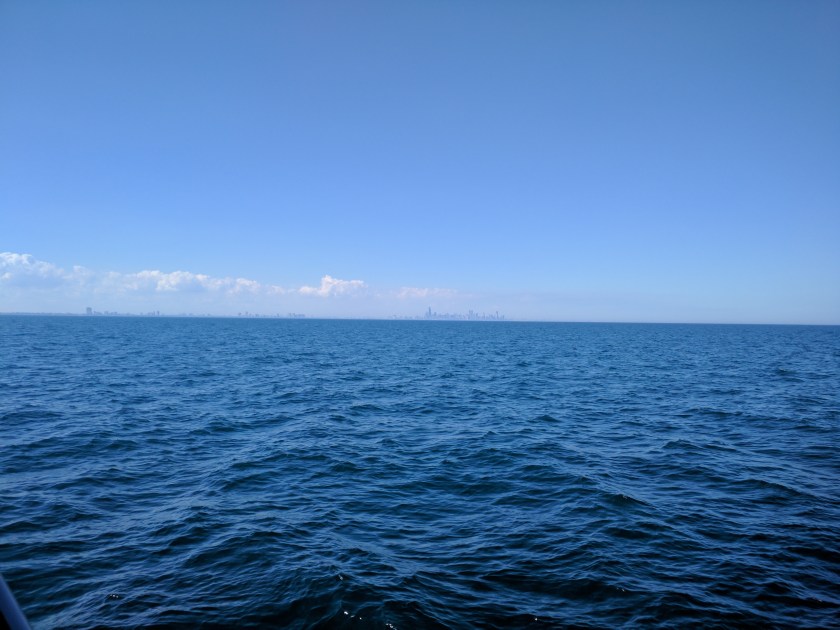
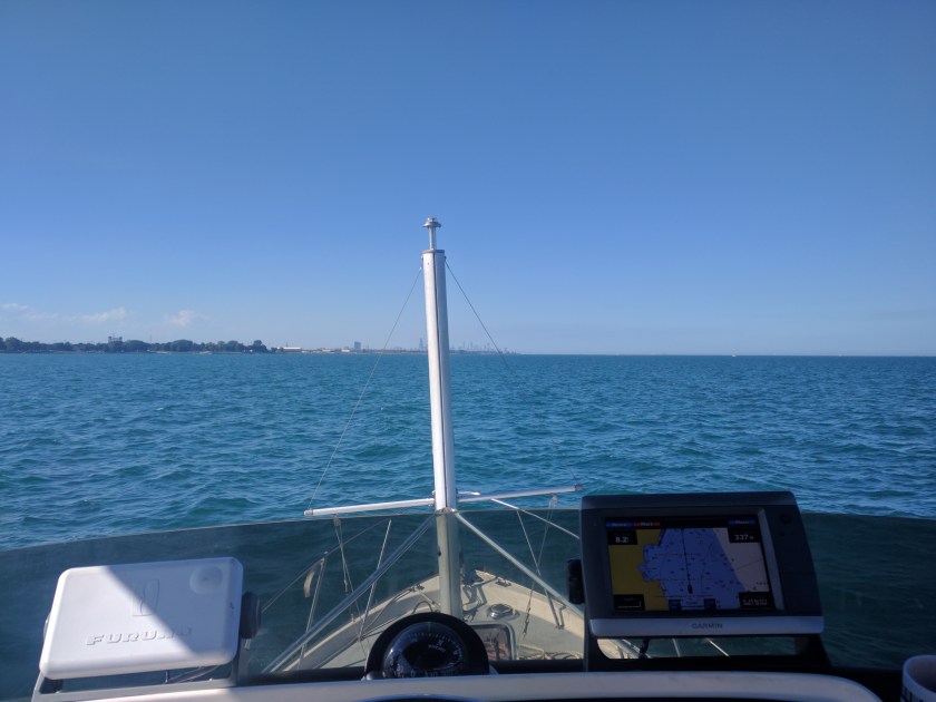
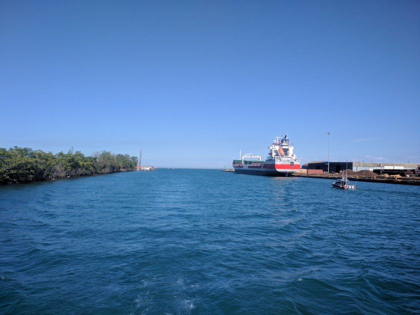
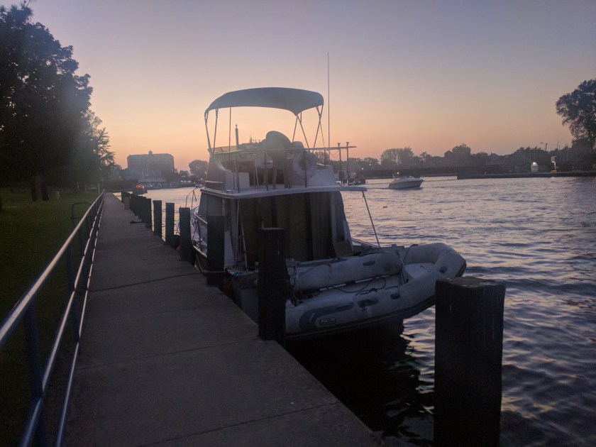
Before I forget – I’m docked basically at the Illinois – Indiana border at the mouth of the Calumet River. If I had visitors (hint hint) I would love to do a boat tour on Mazurka going up the lake to downtown Chicago, into the river, through downtown then into the industrial section and down the Calumet to get back. Any readers of this are encouraged to book now. Just bring a picnic lunch and promise to feign interest :-). I’d promise fall colours but we may not see a lot of trees.

Back to the itinerary. I’ve been making a bit of a study of looping and Loopers. I’m not quite ready to join that club. If I complete the Great Loop I suppose I’ll recognize the occasion, but it is not really a goal, and not really the right identity for me. I do want to recognize the strong community and identity that Loopers have. I’m a member of the AGLA and I think they’ve done a lot to create that identity. From the Trent Severn to Chicago everyone along the way knew about Loopers, and at times it was convenient and helpful to self-identity as a Looper. I was chatting with my old boss and friend Bruce about this and he whipped out the Groucho Marx classic about not wanting to be a member of a club that would have me. That sort of sums it up nicely.

So I need a mission statement. Here goes. And I can’t get the Star Trek intro out of my head.

‘To travel and explore all the inland navigable waters of eastern Canada and the US.”

I don’t think I need to say anything more than that. I don’t really have an end date in mind. I currently have the majority of my time available to dedicate to the mission, but that may change. I have what I think is a reasonable boat to achieve this broad mission. Not perfect, but in general a boat that meets my needs pretty well and that I like a lot.

When I think about what comes next and what I look forward to, the great rivers of the Mississippi basin come to mind immediately. I’ve spent lots of time in SE Florida and the northern Bahamas, and there is some appeal, but I’m also happy avoiding or limiting the whole Florida scene, at least the east coast. And while I haven’t done the entire Atlantic Intracoastal Waterway (AICW) I’ve done enough of it to know what to expect. Concerns there too with the northbound hordes in the spring. I’d rather avoid the crowds. The more I think about it the more I think I should avoid the traditional Looper path.

So for sure I’m leaving Chicago in early November, and my boat will be ready. I’ll travel down the Illinois River to Grafton IL where it flows into the Mississippi. Then down the Mississippi to Cairo IL where the Ohio River enters the Mississippi.

I did the first part of that trip in November 1992 with Samantha on a sailboat with the mast down. We went from Chicago to West Alton. She didn’t much like it, and the Loopers don’t much like this segment either. But I remember it with fondness. The Mississippi segment will be a new adventure, one that I’ve long looked forward to.

What happens at Cairo? That’s the question. The standard Looper route is to leave the Mississippi there, and go briefly up the Ohio, then south to the Kentucky Lakes then down to Mobile AL via the Tennesee-Tombigby waterway. It’s a well traveled path for yachts heading south.

One of the questions is how much time I have to linger and explore. This area is rich with opportunities. I want to do the Ohio and Tennessee rivers end to end. But given seasonal constraints I think I don’t have time before winter. I think I need to be at or near the Gulf coast by late November.

I’m also thinking of my 2019 goals and constraints. I really want to be back in Georgian Bay next summer. It’s beautiful, close to home, and back in Canada.

So here’s my tentative plan. Instead of getting off the Mississippi at Cairo, I will continue on for another 640 miles to the entrance to the Atchfalaya River. From there I do some local exploration and end up going through Morgan City to the gulf. Then I can either turn right towards Texas and Mexico or left towards Alabama and Florida. Or just hang out in the Bayou.

In any case, this plan calls for an early spring trip north through the Tennesee-Tombigbee, hopefully time to explore the Tennessee and/or Ohio rivers, then from Cairo back up to Chicago and from there to Georgian Bay. I have to check weather stats, but winter is pretty brief in the mid south. I have to think I could start north in early March.

I have about six weeks to finalize this plan, and to be honest may not decide which way to go until I’m close to Cairo. Much too depends on water levels and flows. Some angry/dangerous water is inevitable, but caution, diligence and good judgement is called for. But I’m also happy to hunker down when it’s appropriate. Have lots of flexibility and no fixed deadlines.

Probably the biggest argument against this route is that parts of it involve fighting the current. I’m not wild about the idea, but my boat is fast enough to do it, and I can try to pick windows of travel on these segments. In general spring isn’t great because of winter runoff, but with climate change upon us the old generalizations aren’t as useful as they used to be. I’m willing to face those challenges and risks.

Aground Part 4

Hauled the boat at Crowley’s in Chicago today. Damage to the fiberglass along the keel is not a big deal and the glass guys here will do a repair over the next few days.

The big shock came when I saw water seeping out around the drain plug fitting. When I grabbed it it came right out in my hand. I had been taking on some water since the grounding, but in manageable quantities – a few gallons a day. But if the fitting had dropped out when underway I would have had a 1″ hole. Making matters worse I don’t have access to the hole on the inside because there is a drip pan for the motor directly over it.

I did look at this when I hauled after the grounding, but not closely. The brass fitting had taken some damage from the grounding, and I guess the screws holding it in place loosened and dropped out along the way.

I’m feeling very lucky… Maybe my bilge pump could have kept up, but glad to not have found out :-). That’s a good argument for robust pump capacity.

We’re going to fill the hole. I wasn’t using the drain anyway.

I also found that the propeller tips sustained minor damage so will pull it off and send it out to be repaired and balanced.

I have a list of boat repairs and improvements that I’m working on while here. Current plan is to stay here until the first weekend of November then head downriver.

Fuel Economy

A few folks have asked about fuel cost. This is something I have taken lots of interest in. The money certainly matters to me, but I also have a strong sense that we shouldn’t be consuming more fossil fuels than we have to. I have been driving hybrid and electric vehicles for years now, and have made a point of slowing my highway speeds to optimize fuel usage.

In fact, it was my experience with cars that influenced my boat decisions. I wasn’t sure whether I’d be happy going slow. For the most part I am.

My boat was originally delivered with a 165 hp diesel. It currently has a 250 hp diesel. I think of it as a poor person’s fast trawler. I can cruise all day at speeds up to about 15 mph if I want to. It’s a semi displacement hull form, fairly narrow by modern standards and easily driven at a wide range of speeds.

What’s the bottom line? I’m going to use US measurements here, but have a wide variety of metrics. To me the number that matters is mpg.

For my 2018 voyaging I’ve kept careful track of fuel and my consumption for the trip so far has been 4.0 mpg. My average over the last three years has been slightly better @4.15 mpg.

I should also mention that I have a generator as well that shares fuel with the main motor. I use it for cooking, hot water, air conditioning when needed, and battery charging if I’m in one place for days without a plug in. But generally speaking if I’m on the move it doesn’t use much fuel compared to the propulsion motor. Its use is included in my stats.

A lot of boating folks talk about gallons per hour (gph). I guess that’s interesting, but for voyaging the mpg figure makes more sense to me. Here’s some easy math. For a basic great loop voyage of 6,000 miles I’ll use about 1,500 gallons @4 mpg. At $4.00 per gallon that’s $6,000.

I should also say that I have tankage for about 220 gallons. So my range on average is about 800 miles.

So that’s the basics, and it’s not a bad story. Keep in mind that looping 6,000 miles will take a year, so that’s $500/mo for fuel.

Digging deeper into this, my average moving speed to get these numbers has been about 7.3 mph. This is key. Fuel consumption is related to speed. The faster you go the lower the mpg.

Drawing from this year’s experience, the first 400 miles of my trip was through the Trent Severn waterway and inside passage up to Parry Sound. I went at my slow cruising speed of 6.5 – 7.5 mph and got 5.1 mpg. Heading out into rougher open waters of the northern section of Georgian Bay and North Channel I traveled for a day at 11-12 mph and then more moderate speeds of 7-10 up the St Mary’s river, and got about 2.5 mpg on that segment.

My plan for the rivers is to go slow when in slack water or with a favourable current, and I expect to get > 5 mpg under those conditions. At the same time I have the ability to speed up to make deadlines or fight adverse current, which I will do selectively. As long as I maintain this discipline my fuel consumption will remain reasonable.

Chicago!

Am tied up at Crowleys. Off the lakes.

Pics below are coming in across the lake from St Joe’s. I went straight to Hammond Marina to refuel then into the Calumet. Didn’t get close to downtown but was fun to see the towers appear one by one on the horizon. I haven’t approached the city from the water since 1992. It’s pretty spectacular. Not just the loop, but the big plants in Indiana too.

Hiding from the sun in a dark air conditioned boat.

St Joseph’s

Pulling on here I was thinking about May 2016, the last time I was here. That was when I launched my new-to-me boat, and left at dawn on my maiden voyage. We’ve traveled about 5000 miles since then, done a squiggly loop of the great lakes, and more importantly the canals and waterways attached.

I’ve learned a lot, and feel privileged to have been able to do it, and to continue to travel by boat.

I’ve got to say I like my boat, and think I made a good choice given my priorities and budget.

Anyway, it’s kind of cool to come in. I tied up just inside the breakwater on the town wall. Nice spot. Walked a block to a nice Mexican restaurant

Whitehall

Came into the lake at dusk with the intent of anchoring out but then figured I’d noodle up to town. Had a meal out and am now bedding down at the municipal marina which is closed for the season.

Today was the nicest yet. No waves, sunny and pleasant. Basically just following the coast south.

Coming up Whitehall Lake

And a couple of pics on the way down the shore

Frankfurt

Am writing this from the flybridge. Another spectacularly nice evening. I’m anchored in the middle of the lake and all is quiet except for about a dozen boats slowly trawling around. I’m assuming they’ll quit at some point. No bugs but the occasional jumping fish.

Had an uneventful trip down, left at 9:30 and got in here at 7:30. Am going to try to get underway much earlier tomorrow. Voyaging around here is basically done in straight lines in the open lake between ports. Not really my kind of thing. But the weather is perfect. The sun went behind some clouds today for an hour or so. First time in days. I’m sitting out now in shorts and a tee shirt.

In other news, I knew I lost a $50 bill about a month ago. My coffee mug fell off the dash this morning as I was leaving Beaver Island and when I was picking up pieces of the broken mug I found the bill in the drain.

Today I made more of an effort to stay out of the sun. Most of the time I stay outside or stand inside to watch the horizon, to avoid motion sickness. Today was very calm most of the trip, and I could actually relax inside. No other boats around and I was going slow so could pop up every few minutes to look around.

In open water I carry my speed to suit conditions. If it’s really flat I go slow for efficiency, but generally speed up as waves increase. Today was mostly at 6.5 – 7.5 knots.

Weather looks perfect for getting down the lake, waves 1 foot or less through Monday.

Had a good burrito at Dinghy’s restaurant and picked up some milk, had a walk down the main drag. Looks like a nice town.

This was taken around 2:00 after the wind pooped out completely.

Sleeping Bear dunes

Point Betsey light and some houses up on the dunes. Bet they dread every big storm…

I walked down to the park to get a sunset shot

My dinghy

Beaver Island

Cute place, nice anchorage.

https://goo.gl/maps/A2VTfjPtTCq

Had a fine trip today. A bit choppy for the first and last couple of hours, but mostly nice. Sunny and warm. Probably the hardest part of the day was heading west into the sun all evening.

I got underway at 9:00 this morning and came in here about 7:00. Anchored and zipped in by dinghy for dinner in a local pub.

Weather looks like more of the same and calm for the next few days. Should be smooth sailing to Chicago. Am heading down the Michigan shore tomorrow.

Approaching the Mackinac bridge

And a selfie from the West

Lake Michigan through Grey’s Reef passage

And the sunset pic. A bit late getting out of the pub 🙂

Forgot to mention bugs. This is the first time in weeks that I’ve had to keep screens closed. Was swarmed at dusk. Also have ducks pecking at the sides of the boat. It took me a while to figure out what the noise was :-). Have gone out a scared them off a couple of times but they keep coming back. Guess I’ll get used to it.

Welcome to the USA!

Well, that was painless. Got a call from the Port Authority who was issuing my cruising permit. All done, come on over. So I cruised across the river, filled up with fuel while I used ROAM to clear in, then biked up to the border crossing station to pick up the cruising permit.

Got a Verizon Unlimited plan. $75/mo pay as you go. Using it now.

I left the marina about 3:00 and cruised down the ship channel. Only encountered one ship upbound and stayed well out of its way. I’m now anchored in a broad bay with a very light SE breeze. Calm water, no clouds, the only lights I can see are navigation markers. Sitting in the cockpit looking straight at one of the dippers. Shorts and a fleecy. Can’t beat it.

https://goo.gl/maps/TFtJWuombXp

Weather looks like more of the same – clear, warm, calm. As long as I keep lots of sunscreen on I think I’ll be fine :-). Am feeling very good about getting down the lake.

Filled up with fuel. Will publish detailed comsumption stats at some point soon. I care about that.

This was a man-made section of the downbound channel. Pretty good following current, 1-2 knots.

A passing ship

And the obligatory sunset picture. This is almost getting old…